Browse categories
English
$
USD
Connect to your AI

Need clear, accurate maps for your report, research or project? Im a geographer and PhD candidate in Geomatics with 3+ years of experience producing GIS maps and remote sensing analyses for environmental consulting, mining and public agencies.
What I offer:
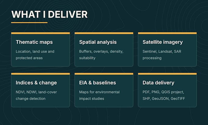
Thematic and location maps
Spatial analysis: buffers, overlays, density, suitability
Satellite imagery processing: Sentinel, Landsat, SAR
Vegetation and water indices (NDVI, NDWI) and change detection
Land-use and land-cover classification
Georeferencing and digitizing
Maps for Environmental Impact Assessments (EIA) and environmental baseline studies
Software: QGIS, Google Earth Engine, SNAP, Python
Deliverables: high-resolution PDF and PNG; editable QGIS project (.qgz), vector and raster data (SHP, GeoJSON, KML, GeoTIFF) depending on the package.
What I need from you: your data (or a description of what you need), the area of interest and the purpose of the map.
Please message me before ordering, so I can confirm the scope and recommend the right package. Larger projects get a custom quote.
GIS and Remote Sensing Analyst, Maps, Satellite Imagery, Power BI
Languages
What do you need from me to start?
Your data (shapefiles, Excel with coordinates, KML, etc.) or a description of what you need, the area of interest and the purpose of the map. If you don’t have data, I can use public sources like satellite imagery or OpenStreetMap.
Can you work with ArcGIS files?
Yes. I can open shapefiles, geodatabases and GeoTIFFs, and deliver data in formats fully compatible with ArcGIS. The editable map project is delivered in QGIS (.qgz).
Which satellite imagery do you use?
Mainly free imagery such as Sentinel-1 (SAR), Sentinel-2 and Landsat, processed in Google Earth Engine, SNAP or QGIS. If you have commercial imagery, I can work with it too.
Can I request changes after delivery?
Yes. Each package includes revisions, and you can add extra revisions if needed. Changes that modify the original scope may require a custom quote.
Do you work on large or custom projects?
Yes. Please message me with the details before ordering and I’ll send you a custom offer.