Browse categories
Explore
Fiverr Pro
English
$
USD


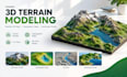
Need a detailed 3D terrain model or custom topographic map for your project?
I create custom 3D terrain models, topographic maps, relief maps, and digital landscape models tailored to your requirements.
Whether you need a mountain terrain model, a geographical relief map, a landscape visualization, or a 3D-printable terrain model, I can help turn your reference materials into a detailed 3D representation.
MY SERVICES INCLUDE:
WHAT YOU CAN EXPECT:
I can work from map references, images, sketches, measurements, and compatible elevation data, depending on the project.
Before ordering, please contact me with your project details, reference materials, required dimensions, intended use, and preferred file format.
Let's turn your terrain concept into a detailed 3D
Please inform the freelancer of any preferences or concerns regarding the use of AI tools in the completion and/or delivery of your order.
3D Terrain Modeler Topographic Maps and 3D Landscapes
Languages
What types of terrain models can you create?
I can create custom terrain models, topographic maps, relief maps, mountain landscapes, and selected geographical or architectural terrain models, depending on the project requirements.
Can you create a model from a map or location?
Yes, provided suitable reference materials or compatible geographical data are available. The quality and accuracy depend on the source data.
Can you deliver STL files?
STL delivery is available for projects where the model is prepared for 3D printing and the selected package includes that format.
Can you create CNC-ready terrain models?
CNC-ready output can be discussed based on the machine requirements, model geometry, and intended manufacturing process.
Which file formats do you support?
Depending on the project and your capabilities, supported formats may include STL, OBJ, FBX, and BLEND.
Can you customize the model dimensions?
Yes. Please provide your required dimensions, scale, or geographical coverage before the project begins.
Can you model a large geographical area?
Large areas require an individual assessment because terrain complexity, data availability, resolution, and output requirements affect the workload.
Do you offer revisions?
Yes. Each package includes a specified number of revisions. Requests that significantly change the original project scope may require an additional payment.
