Looks Like This Service Is On Hold

I will create and train machine learning models for image analysis

T
tewabemelkamu
T
tewabemelkamu
Tewabe M

About this gig

WELCOME TO MY GIG!


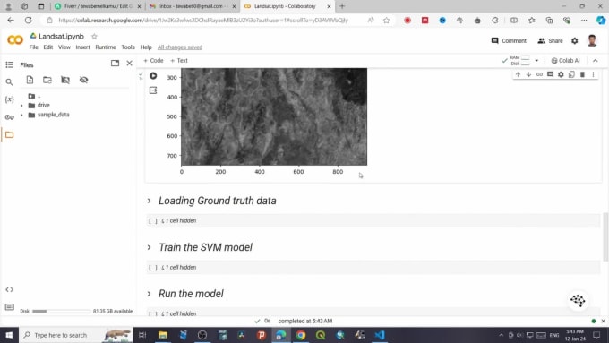
Hi there, I'm Tewabe, Geospatial sciem expert with 4 years of experience in satellite image analysis. I can help you with any project that involves creating and training machine-learning models for satellite image analysis.


I am experienced in the following methods of machine learning:

  • Linear Regression
  • Linear Classification
  • Support Vector Machines
  • Logistic Regression
  • Decision Trees
  • K-Nearest Neighbors
  • Random Forest
  • Bayesian Regression
  • Convolutional Neural Networks (CNN)
  • Artificial neural networks (ANN)


I use the following tools to perform your tasks:

  • Python
  • Tensorflow
  • NumPy
  • Keras
  • Scikit-learn
  • OpenCV
  • matplotlib
  • pandas


Please get in touch with me before placing orders.

Get to know Tewabe M

Tewabe M

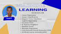
Exploring the science of where!

4.7(2)
  • FromTaiwan
  • Member sinceAug 2021
  • Last delivery1 year
  • Languages

    English, Amharic, Chinese, Arabic
Hi there, My name is Tewabe. I have a B.Sc. degree in Earth Science and an M.Sc. degree in Remote Sensing and Geoinformatics. For the last five years, I was working as a lecturer in Ethiopia. Currently, I am pursuing my Ph.D. in the Center for Space and Remote Sensing Research Institute, Taiwan. I am a dedicated GIS, remote sensing, and geospatial science specialist. I am passionate about working with spatial data to address complex problems tagged with "where?" I look forward to collaborating with you on your GIS, remote sensing, and geospatial projects. Thank you!

My Portfolio