Browse categories
Explore
Fiverr Pro
English
$
USD

Welcome!
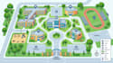
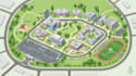
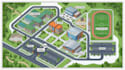
I create clear and visually engaging illustrated maps for universities, schools, campuses, institutions, and large facilities.
I can turn your existing plans, aerial references, sketches, PDFs, or location information into an organized map that helps students, visitors, staff, and guests understand the location and find important facilities easily.
My campus and wayfinding maps can include:
I focus on clean organization, readable information, consistent symbols, and a professional visual presentation suitable for digital use, visitor guides, signage, brochures, presentations, websites, and printed materials.
Please send your reference files, location information, required facilities, preferred style, and final output requirements before ordering.
Please inform the freelancer of any preferences or concerns regarding the use of AI tools in the completion and/or delivery of your order.
Turning Complex Spaces Into Clear, Professional Maps
Languages
Can you create a map from a PDF or existing campus plan?
Yes. I can use PDFs, drawings, aerial references, sketches, images, or other suitable reference materials.
Can you include individual buildings and facilities?
Yes. Buildings, academic facilities, administration areas, parking, sports facilities, entrances, walkways and other important locations can be incorporated.
Can you create a map for a school or college?
Yes. I can create maps for schools, colleges, universities, training institutions and other educational facilities.
Can you create a visitor or wayfinding map?
Yes. The map can be organized around visitor movement, entrances, important destinations, pathways and directional information.
What files can I provide?
You can provide PDFs, CAD drawings, images, aerial references, sketches, existing maps or other relevant location information.
Can you prepare the map for printing?
Yes. I can prepare the final artwork according to the required dimensions and suitable export format for print or digital use.


