I will georeference, digitize scanned maps and gis mapping

U
ubaidullah28
U
ubaidullah28
Ubaidullah

About this gig

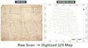
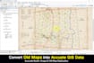
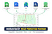
I georeference scanned/raster maps and digitize spatial data into accurate GIS layers shapefiles ready for analysis, GIS mapping, or planning.

With 5+ years of GIS experience, I use ArcGIS and QGIS to deliver precisely aligned, topology-verified datasets in WGS84 or your preferred coordinate system.


What I offer:

  • GIS mapping and custom maps
  • Georeferencing scanned/raster maps and satellite imagery
  • Digitizing spatial data with accurate attributes
  • Raster-to-vector conversion
  • Topo mapping and terrain-based layer creation


Why work with me:

  • Precision alignment, not rough estimates
  • Clean, structured datasets ready for real project use
  • 5+ years of hands-on GIS and urban planning experience

To get started, please share: scanned map/imagery, target coordinate system, and layer list needed.


Tools: ArcGIS Pro, QGIS

Get to know Ubaidullah

Ubaidullah

GIS Analyst CAD to GIS Expert

5.0(1)
  • FromPakistan
  • Member sinceJun 2021
  • Avg. response time1 hour
  • Last delivery5 days
  • Languages

    English, Urdu
I am a GIS Analyst with 5+ years of experience in spatial data engineering and urban master planning. I specialize in converting complex CAD data into high-quality, topology-verified GIS datasets. From thousand acre residential schemes to precise georeferencing and 3D surface modeling (DEM/TIN), I provide professional-grade geospatial solutions using ArcGIS, ArcGIS Pro, QGIS, and Python automation. GIS Mapping Spatial Analysis CAD to GIS Conversiom Georeferencing Remote Sensing ArcGIS Pro Digital Elevation Models (DEM) Town Planning Python for GIS Topology Cleaning

My Portfolio