Browse categories
Explore
Fiverr Pro
English
$
USD
I will create gis web maps, interactive maps, spatial analysis and 3d maps


Urelles Dillard
About this gig
A GIS map should do more than display data it should reveal patterns, relationships, and locations that support better planning and decisions.
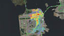
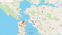
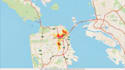
I create GIS web maps, interactive maps, spatial analysis, and 3D maps that turn complex geospatial data into clear, usable visual information.
Why you may need this:
- Understand spatial patterns and relationships
- Present location-based data through interactive web mapping
- Visualize terrain, assets, and development scenarios in 3D
I can provide:
- GIS Web Maps
- Interactive Web Maps
- Spatial Analysis
- 3D GIS Maps
- ArcGIS Mapping
- QGIS Mapping
- Mapbox Maps
- Leaflet Maps
- Thematic Maps
- Location Analysis
- Terrain Analysis
- Buffer Analysis
- Overlay Analysis
- Site Suitability Analysis
- Spatial Data Visualization
Why choose me?
- Analysis-driven mapping rather than basic map styling
- Clear visualization of complex spatial information
- Practical GIS outputs built around your project objectives
Have spatial data that needs to become useful information? Send your datasets and project requirements, and lets turn your location data into a GIS map or analysis you can actually use.
Delivery style preference
Please inform the freelancer of any preferences or concerns regarding the use of AI tools in the completion and/or delivery of your order.
Get to know Urelles Dillard
Urelles Dillard
GIS Geospatial Consultant And Mapping Spatial Analysis
- FromUnited States
- Member sinceJul 2026
- Avg. response time1 hour
Languages
English
I’m a GIS & Geospatial Consultant helping clients turn complex location, terrain, and spatial data into reliable information for engineering, planning, land development, surveying, and environmental projects. I specialize in GIS mapping, ArcGIS, QGIS, spatial analysis, remote sensing, web maps, plat maps, golf course maps, LiDAR processing, terrain modeling, parcel mapping, and 2D/3D visualization. I develop practical geospatial workflows that clarify site conditions, communicate findings, and support confident project decisions.