Browse categories
Explore
Fiverr Pro
English
$
USD


hello and welcome!
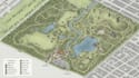
I design clear, professional maps for parks, hiking trails, outdoor destinations and visitor attractions.
Whether you need a clean vector map for print, an isometric map for presentation, or a detailed visitor map for guests, I can turn your information and references into a polished map that is easy to understand and enjoyable to use.
My maps can include trails, paths, landmarks, facilities, buildings, entrances, parking areas, natural features, icons, labels and wayfinding elements.
why choose to work with me!
Send me your existing map, sketch, site information, GPS data or reference materials, and I'll create a map around your needs.
NOTE MESSAGE ME BEFORE ORDER!
Please inform the freelancer of any preferences or concerns regarding the use of AI tools in the completion and/or delivery of your order.
professional map designer
Languages
Can you create a map from a sketch or rough reference?
Can you create a map from a sketch or rough reference? Yes. I can work from sketches, screenshots, existing maps, satellite references, GPS information or other materials you provide.
Can you design hiking and trail maps?
Yes. I can create hiking routes, trail networks, points of interest, elevation-related information and supporting map elements
Can you create a visitor map for a park or attraction?
Absolutely. I can organize entrances, trails, facilities, landmarks, parking, rest areas and wayfinding elements into a clear visitor friendly layout.
Can you create both vector and isometric maps?
Yes. I can create clean 2D vector maps as well as more dimensional isometric-style maps depending on the project.
Will the map be suitable for printing?
Yes. I can prepare the final artwork at the required size and resolution for professional printing.
Can you use my existing map information?
Yes. You can provide your existing map, CAD/GIS information, sketch, reference images or other project data.


