Browse categories
Explore
Fiverr Pro
English
$
USD



Welcome to my gig:
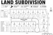
Transforming property ideas into clear, organized, and professional CAD drawings, I create subdivision, site, plot, and land development plans tailored to your project requirements.
I can prepare accurate 2D CAD drawings using your survey, property dimensions, sketches, existing plans, or other reference information.
My service can be used for:
Whether you have a rough sketch or detailed survey information, I can turn your requirements into a clean and understandable drawing.
Please note: drawings are prepared according to the information and requirements supplied by the client. Local planning approval, surveying, engineering certification, or legal approval is not included unless specifically agreed.
Send your project information, and Ill create a suitable package for your needs.
Fiverr does not screen freelancers in this category. Please verify qualifications and discuss requirements with the freelancer before ordering, including any preferences regarding the use of AI tools.
Land Subdivision, Site Planning Expert AutoCAD Civil 3D and GIS
Languages
Can you create a subdivision plan from a survey?
Yes. I can use a property survey, site measurements, PDF, image, CAD file, or other suitable reference information to prepare the subdivision layout.
Can you divide one property into multiple lots?
Yes. I can draft proposed lot divisions showing boundaries, lot arrangement, dimensions, access and other requested site information.
Do you provide editable CAD files?
Yes. Editable CAD files can be included depending on the package selected.
Can you include roads, parking and building areas?
Yes. Roads, driveways, parking, building footprints, setbacks and other site components can be incorporated when the required information is provided.
Can you prepare plans for planning or permit submission?
I can prepare professional drafting based on your supplied requirements and local guidelines. However, approval, surveying, engineering certification, or legal/planning sign-off is not guaranteed and should be completed by the appropriate licensed professional where required.


