Browse categories
Explore
Fiverr Pro
English
$
USD


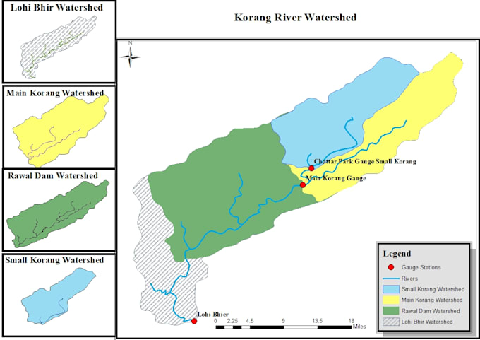
Specialize in ArcGIS elevation maps with clean symbology and professional layout ready for your reports and presentations.
Unlike basic map sellers, I deliver high-resolution, print-ready elevation maps with full legend, scale bar, and north arrow.
With a background in civil engineering and hydrology, I understand terrain data and deliver accurate results.
"Perfect for: site planning, flood risk assessment, environmental reports, and academic projects.
Just send me your area of interest or DEM file; I will handle the rest.
Civil Engineer
Languages