Browse categories
English
$
USD
Connect to your AI



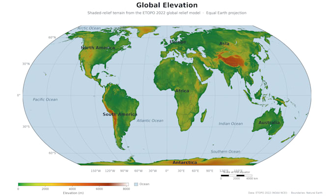
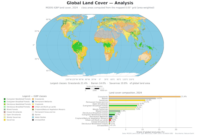
Hi, I'm Bill a GIS and remote sensing specialist. I turn satellite imagery and spatial data into clear, publication quality maps and solid, honest analysis. WHAT I DO Study area and thematic maps, land use classification from Sentinel-2 and Landsat, NDVI and change detection, DEM terrain analysis, buffer and overlay analysis, raster and vector processing. TOOLS QGIS, GDAL, Python, Google Earth Engine, ENVI. WHAT YOU GET Print ready maps at 300 DPI, Standard and Premium include source data and methods note. Accuracy is always stated honestly. Send me your data and study area first, I'll confirm scope and price before you order.
GIS and remote sensing specialist
Languages
What do you need from me to start?
Your data (shapefile, GeoTIFF, GeoPackage, or a CSV with coordinates) — or just tell me your study area. If you have no data, I can often work with open satellite imagery (Sentinel-2, Landsat) and open elevation data.
What formats will I receive?
Print-ready maps at 300 DPI in PNG and PDF. Standard and Premium also include the source data (GeoTIFF / shapefile / GeoPackage) and a short methods note.
Do you deliver ArcGIS project files (.aprx)?
No. I work in QGIS and open-source tools, so I deliver finished maps and standard data formats that open anywhere — but not .aprx project files.
Is my data kept confidential?
Yes. Your data is used only for your order, never shared, never reused, and deleted on request.
What if my data can't produce what I want?
I'll check before you pay and tell you honestly what is and isn't possible — no charge for bad news.