Browse categories
Explore
Fiverr Pro
English
$
USD

Level 2

Do you need to convert GIS data into another file format?
I will convert your vector GIS files between Shapefile, KML, GeoJSON and CSV using QGIS, then check the converted result.
Depending on the selected package, you can receive:
conversion to one or more output formats
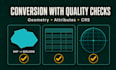
geometry and attribute checks
coordinate reference system (CRS) verification
a map preview of the converted data
a validation summary for the Premium package
Please upload Shapefiles as a ZIP containing the related SHP, SHX, DBF and PRJ files. One complete Shapefile set counts as one GIS file.
Different formats do not always support the same geometry types, field types, styling or CRS information. Any relevant limitations or missing information will be clearly reported.
This gig covers vector data conversion. It does not include digitizing, georeferencing, raster or CAD conversion, or manual repair of severely damaged data.
Please contact me before ordering if your files are corrupted, unusually large, contain many layers, have a missing CRS or require a format not listed above.
Custom map artist and illustrator
Level 2
Languages
How should I upload a Shapefile?
Please place the SHP, SHX, DBF and PRJ files in one ZIP archive. The complete Shapefile set counts as one GIS file.
Will all geometry and attributes remain unchanged?
I will check the converted geometry and attributes, but different formats do not support exactly the same features, field types, styling or CRS information. Any relevant limitations will be reported.


