GIS Analyst Remote Sensing Satellite Imagery AI Automation Engineer
Pakistan
English, Urdu
About me
GIS and remote sensing analyst with a BSc (Hons) in Space Science.
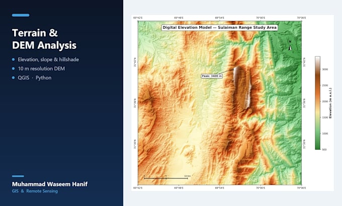
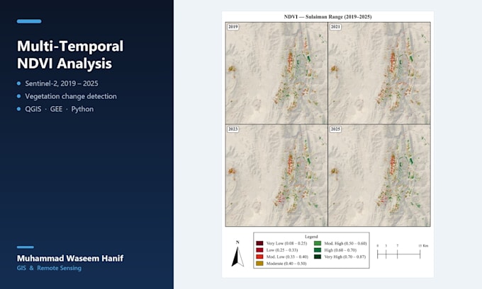
My research mapped forest cover change across Pakistan's Sulaiman Range over four post-monsoon seasons (2019-2025) using Sentinel-2 imagery and NDVI, RVI and FSI analysis - now written up for journal submission.
I work in QGIS, Google Earth Engine and Python, including deep learning pipelines that extract features from satellite imagery.
Tell me your area and dates and I'll say honestly what the data can and can't show before you order.... Read more