Browse categories
Explore
Fiverr Pro
English
$
USD
Environmental Data Analyst, GIS and Remote Sensing Specialist, MPhil Botany
I am an MPhil scholar in Botany with specialized expertise in environmental and climate data analysis. I provide professional GIS mapping, remote sensing data processing, and climate/hydro-climatic data analysis services using tools like ArcGIS, QGIS, Excel, R, and Python (Google Colab).
My services include:
Whether you need a quick GIS map, a detailed climate dataset analysis, or full support for a thesis chapter or research paper, I bring accuracy, clarity, and academic rigor to every project.
I am committed to clear communication, timely delivery, and high-quality results. Let's discuss your project requirements message me anytime with questions!


What software/tools do you use?
I primarily use ArcGIS, QGIS, Excel, R, and Python (Google Colab) for GIS mapping, remote sensing, and data analysis tasks.
Do you have experience with climate data (CMIP)?
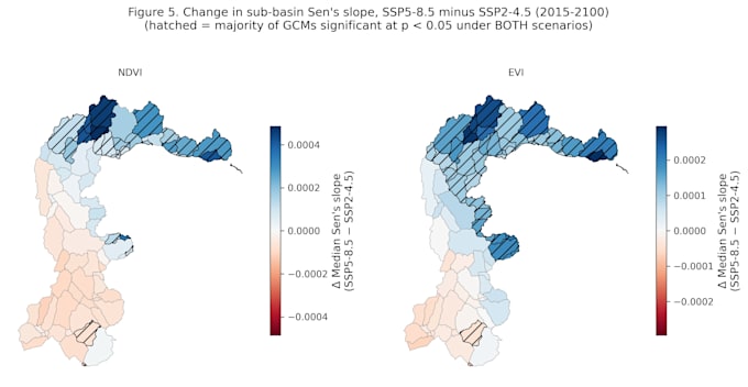
Yes, my MPhil research involved hydro-climatic analysis and future climate projections using CMIP data, focused on vegetation dynamics in a river basin.
Can you handle both GIS mapping and academic writing?
Yes, I offer both , from spatial analysis and map creation to writing, editing, and formatting scientific reports or thesis chapters.
What information do you need from me to start?
Please share your dataset (if available), study area details, and a brief description of what output you're looking for (maps, analysis, report, etc).
Do you offer revisions?
Yes, each package includes a set number of revisions to ensure the final output meets your requirements.