Browse categories
Explore
Fiverr Pro
English
$
USD

Drone Imagery Processing and GIS Expert
Skills
See my services
ELFADILY GEOCONSEIL
Freelance • 7 mos
High-Resolution GeoTIFF Export for GIS and Image Analysis
Jul 2025 - Oct 2025 • 3 mos
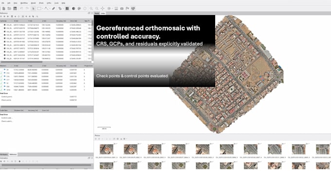
Generated high-resolution orthographic GeoTIFF imagery and elevation products based on defined project boundaries and coordinates. The workflow included raster validation, projection control, and export through GIS tools to deliver GIS-ready datasets suitable for spatial analysis, visualization, and AI-based image processing
3D Model & Point Cloud Processing from Nadir and Oblique Imagery
Jul 2025 - Sep 2025 • 2 mos
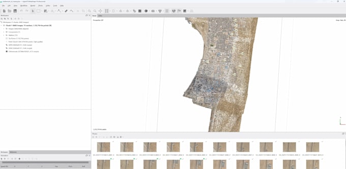
Processed mixed nadir and oblique drone imagery to generate detailed 3D models, orthomosaics, and dense point clouds. The workflow focused on alignment optimization, tie-point filtering, dense cloud cleaning, and accuracy refinement. Outputs were prepared for visualization and analysis, balancing geometric accuracy and visual quality.
Orthomosaic & DEM Generation for Planimetric Mapping
Jul 2025 - Sep 2025 • 2 mos
Processed nadir drone imagery to generate high-accuracy orthomosaics and DEMs for planimetric mapping and technical drawings. The workflow included image alignment, dense point cloud generation, ground filtering, and DEM extraction with fixed spatial resolution. Projects were delivered in local and georeferenced coordinate systems, with and without GCPs, ensuring reliable distances and elevations for GIS and surveying use.
