Browse categories
Explore
Fiverr Pro
English
$
USD


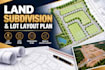
Welcome to your professional Land Subdivision and Lot Layout planning service!
Are you a real estate developer, landowner, or investor looking to maximize the value of your property? I will design high-quality, professional land subdivision plans and lot layouts tailored to meet your development goals and optimization needs.
With extensive experience in urban planning and civil drafting, I transform raw plots, acreage, or estates into optimized, highly marketable residential or commercial lots.
What I Offer:
Note: Please message me before ordering to discuss your property dimensions, minimum lot sizes, and local constraints!
Fiverr does not screen freelancers in this category. Please verify qualifications and discuss requirements with the freelancer before ordering, including any preferences regarding the use of AI tools.
Professional Architect and Layout Drawings Expert
Languages
Do you guarantee approval from my local council or zoning board?
No. My designs are conceptual and optimization layouts based on the guidelines you provide. While they are drafted to professional industry standards, official approvals usually require localized, stamped civil engineering licenses or land surveyor seals.
What file formats will I receive?
Depending on your package, you will receive high-resolution PDFs, presentation PNGs/JPGs, and the native AutoCAD editable source file (.DWG).
Can you work with just a Google Earth screenshot or address?
Yes, I can use a Google Maps link or address to fetch satellite imagery to establish a baseline layout. However, a proper survey map or deed description ensures the highest accuracy.
