Browse categories
Explore
Fiverr Pro
English
$
USD
GeoAI Architect, Spatial Data Scientist and GIS Specialist
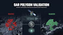
I help companies, researchers and GeoAI teams validate geospatial data using Sentinel-1 SAR imagery and remote sensing analysis.
This service provides objective geospatial quality assurance, polygon validation and satellite-based verification workflows for mapping, environmental monitoring, GeoAI training data and large-scale geospatial projects.
Services may include:
- Geospatial Data Validation
- SAR-Based Quality Assurance
- Satellite Imagery Analysis
- Polygon Verification
- Remote Sensing Analysis
- GeoAI Training Data QA
- Validation Reports and QA Scores
Technologies: Sentinel-1, Python, GIS, Remote Sensing and Spatial Analysis.

Do you provide ground-truth verification?
No. This service evaluates polygon consistency using Sentinel-1 SAR observations and geospatial quality assurance methods. It does not replace field surveys or direct ground-truth data collection.
What data do I need to provide?
You only need to provide your polygon dataset (GeoJSON, Shapefile, KML or similar) and a description of the area or project. I will handle the Sentinel-1 SAR data acquisition and processing workflow.
Can this be used for GeoAI training data validation?
Yes. The workflow evaluates polygon consistency using Sentinel-1 SAR observations and quality assurance methods, helping identify polygons that may require further review before being used in GeoAI, machine learning or large-scale geospatial workflows.
What is included in the validation results?
Depending on the selected package, results may include SAR evidence layers, validation reports, QA scores, VALIDATED/REJECTED classifications and API-ready outputs.
Which SAR sensors do you support?
This workflow is primarily designed for Sentinel-1 SAR imagery, but it can be adapted to other radar datasets depending on project requirements.
Can you process large datasets?
Yes. The workflow can be adapted for large polygon collections, automated validation pipelines and enterprise-scale geospatial projects.
Can you integrate the workflow into my existing system?
Yes. The Premium package includes options for API-ready outputs and integration into existing geospatial or GeoAI workflows.
Why use Sentinel-1 SAR instead of optical imagery?
Sentinel-1 SAR uses observations from known acquisition dates and is not affected by clouds or daylight. Unlike many optical mosaics, it provides more consistent data for geospatial validation.
What industries can benefit from this service?
This service is suitable for GeoAI, environmental monitoring, land-cover mapping, ESG analytics, Earth observation projects, geospatial data production, and satellite-based quality assurance workflows.


